
RHJ: Lost Bridges of Rome
BEFORE CONCRETE SPANS MADE CROSSING ROME’S RIVERS ALMOST INVISIBLE, THE BRIDGES WERE PART OF THE SKYLINE.
By Jeb Arp
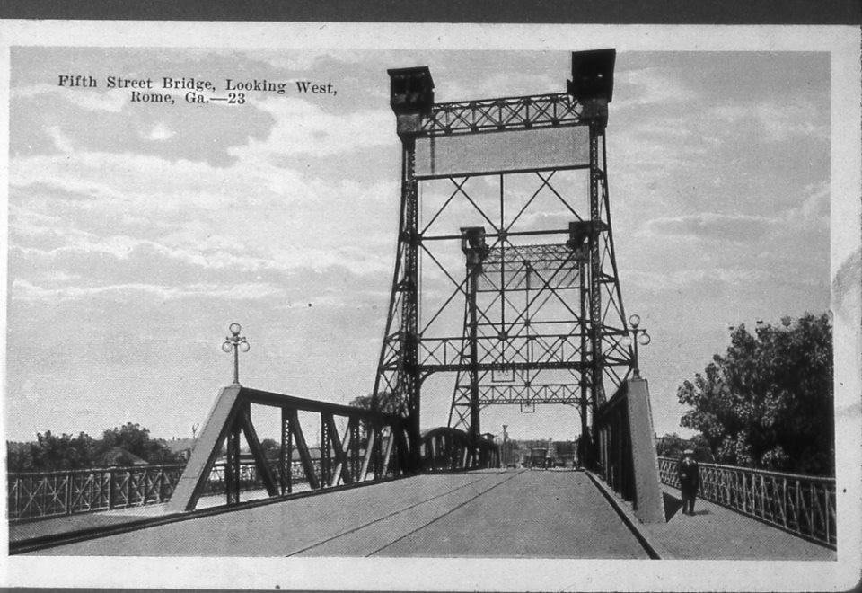
It is difficult to tell the story of Rome without telling the story of its rivers. The Oostanaula, Etowah and Coosa shaped where the city was built, where neighborhoods developed, how goods arrived, and how people moved. They gave Rome much of its beauty.
They also created a problem. You had to get across them.
Today, we barely think about it. Drive down Second Avenue, Broad Street, or Fifth Avenue and the transition from land to bridge can happen almost without notice. The roadway simply continues across the water.
Old photographs of Rome show something very different. Bridges once announced themselves. Steel trusses rose above the street. Towers framed the roadway. Streetcars disappeared beneath webs of iron. Railroad bridges turned on center piers so steamboats could pass. Crossing the river wasn't simply a continuation of the street—it was an architectural and engineering event.
And Rome had a surprising number of them.
Some were destroyed by floods. Some were replaced when traffic outgrew them. Others disappeared as railroads changed or navigation on the rivers declined. One survives because somebody found another use for it. Together, they tell a part of Rome's architectural history that is easy to overlook precisely because so much of it is gone.
A City That Had to Learn to Cross Water
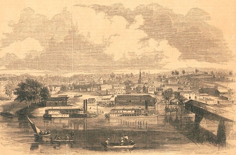
Rome's geography made bridges essential almost from the beginning. Downtown developed between three rivers, with neighborhoods, roads, industries, rail lines and eventually streetcar routes extending outward on the opposite banks.
Then came the flood of 1886. The Howard Street (now 2nd Ave) bridge was destroyed that April, and contemporary accounts describe catastrophic damage elsewhere. When the water receded, the Fifth Avenue crossing of the Oostanaula was reportedly the only public bridge into Rome still standing.
That alone helps explain why Rome's bridges were never merely infrastructure.
They were lifelines.
Fifth Avenue: A Bridge With a Skyline
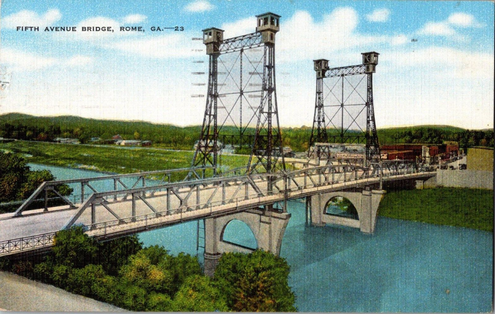
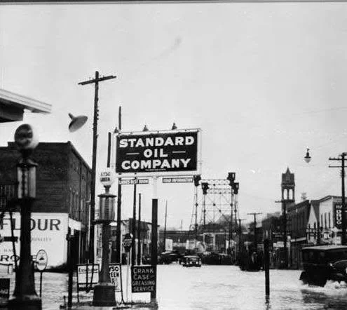
Of all the vanished bridges in these photographs, the old Fifth Avenue Bridge may be the most visually astonishing.
Look at the postcard.
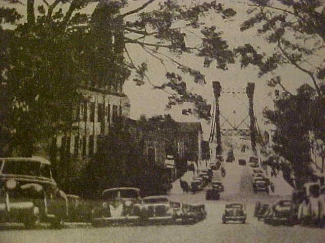
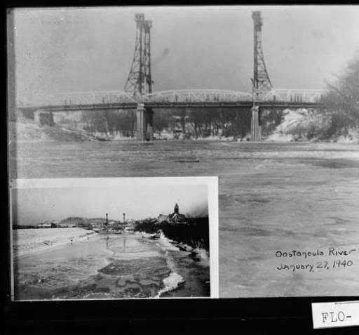
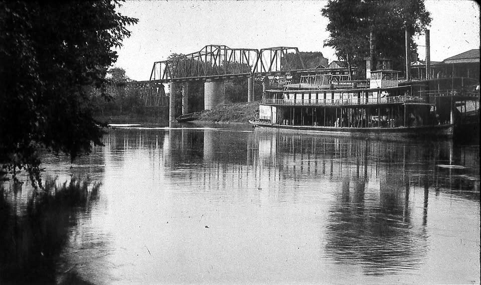
Four towers rise above the Oostanaula, connected by delicate steelwork. Between them sits the roadway, carried across a combination of trusses and masonry piers. It looks less like something you simply drove across and more like a piece of industrial architecture.
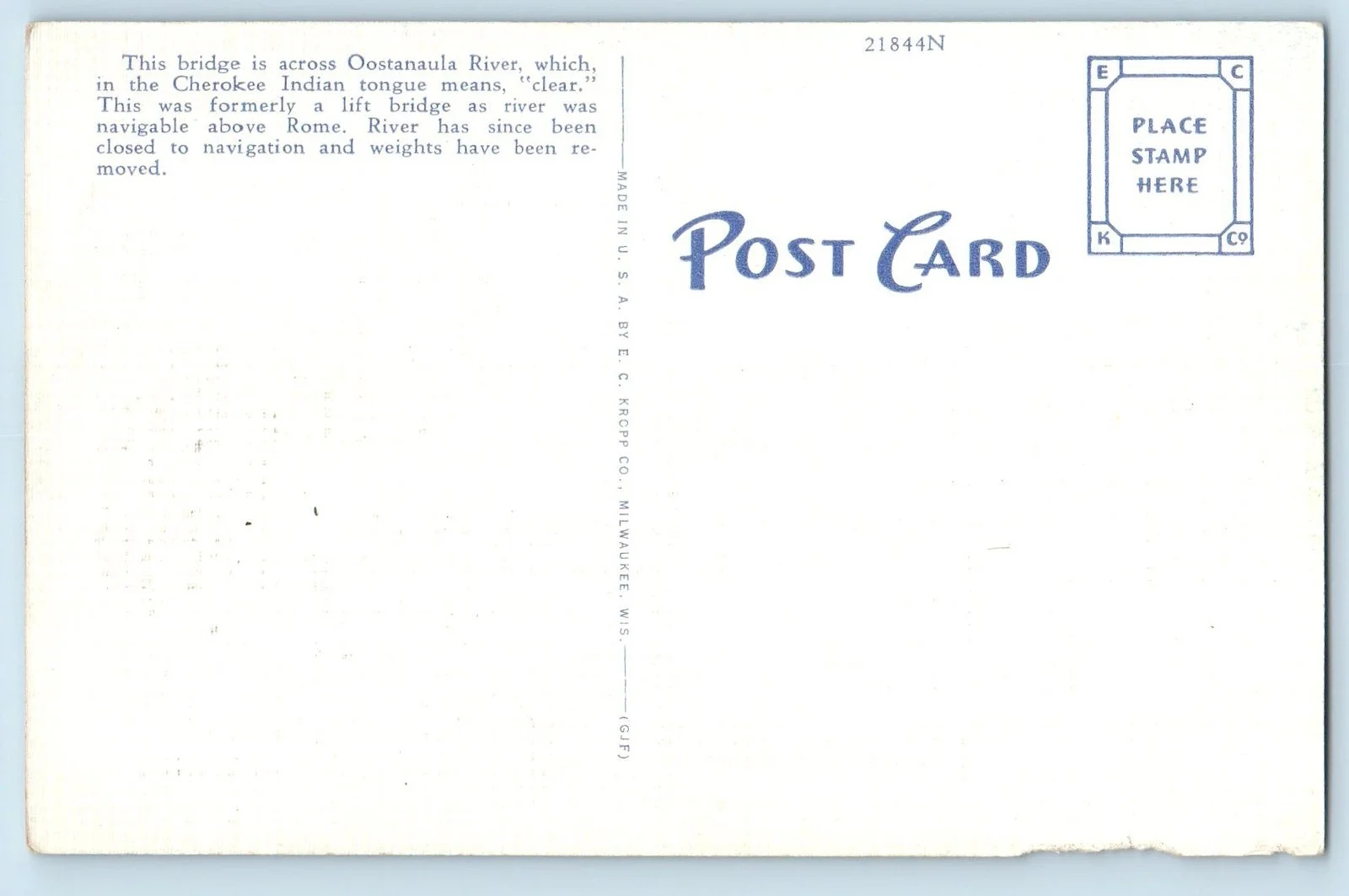
Those towers had a purpose. The twentieth-century Fifth Avenue crossing was a movable bridge—a vertical-lift structure designed so a portion of the bridge could be raised to allow river traffic to pass beneath. Historic bridge records classify it as a Camelback through-truss vertical-lift bridge.
That feature makes much more sense when we remember something modern Rome easily forgets: these rivers were transportation routes, too.
A bridge couldn't simply connect one side of town to the other. It also had to coexist with traffic moving along the river.
The Fifth Avenue crossing itself was much older than the steel bridge in these photographs. Bridge Street—the earlier name for Fifth Avenue—had a wooden bridge across the Oostanaula during the Civil War. One account describes it being packed with hay soaked in turpentine in 1863 so it could be burned if Union forces threatened the city.
By the early twentieth century, Rome needed something considerably more substantial.
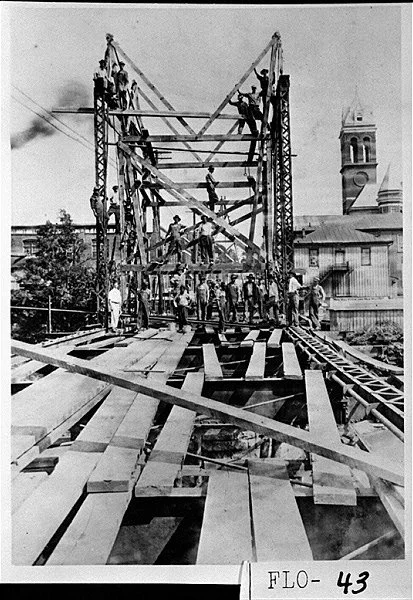
A Georgia Archives photograph documents construction of the new Fifth Avenue Bridge in 1916. The image is remarkable: workers balance across the emerging steel structure while the Floyd County Courthouse rises behind them.
The finished bridge changed the view of the river completely. Its lift towers became landmarks visible from blocks away. In old views looking down Rome's streets, they punctuate the horizon almost like church steeples.
That's what we've lost that is hardest to understand from a map. The bridge didn't merely cross the Oostanaula. It was part of Rome's skyline.
Second Avenue: Before the Bridge Became Invisible
Second Avenue has an even more complicated bridge history.
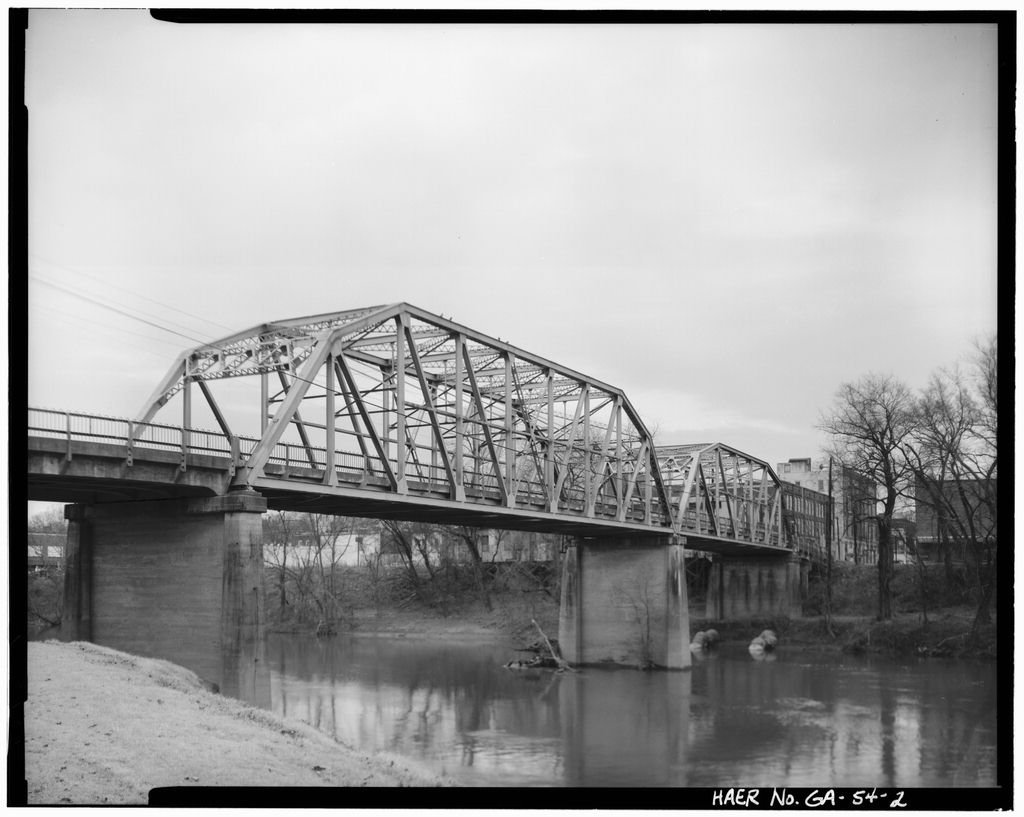
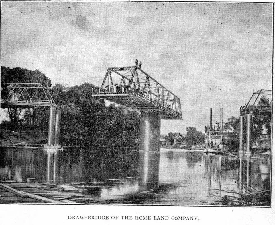
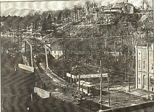
Howard Street, as Second Avenue was originally known, had a river crossing by the nineteenth century. Horse-drawn streetcars were using it by 1885. The bridge was destroyed in the flood of April 1886 and rebuilt, and a later history describes the Rome Land Company opening an iron drawbridge at the foot of Howard Street as development pushed westward.
The sequence of replacements matters because the photographs show just how quickly bridge technology was evolving. Wood gave way to iron and steel. Movable spans accommodated river navigation. Streetcars added another layer of infrastructure. As automobiles became dominant, bridges became wider, heavier and increasingly engineered around vehicular traffic.
Unlike today's bridge, you didn't just travel over the structure. You traveled through it.
The trusses enclosed the roadway and created a repeating rhythm of steel overhead. The bridge became a gateway between downtown and the western bank of the Oostanaula.
Its architectural importance was recognized late in its life. When the Between the Rivers Historic District was listed in the National Register of Historic Places in 1983, the 1930 Second Avenue bridge was considered part of the historic district. Yet shortly afterward, it was demolished and replaced. National Register documentation from 1988 specifically notes that the historic bridge had disappeared after the district was listed.
South Broad: The Bridge the Flood Took
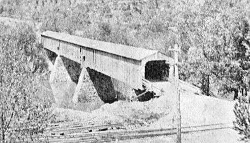
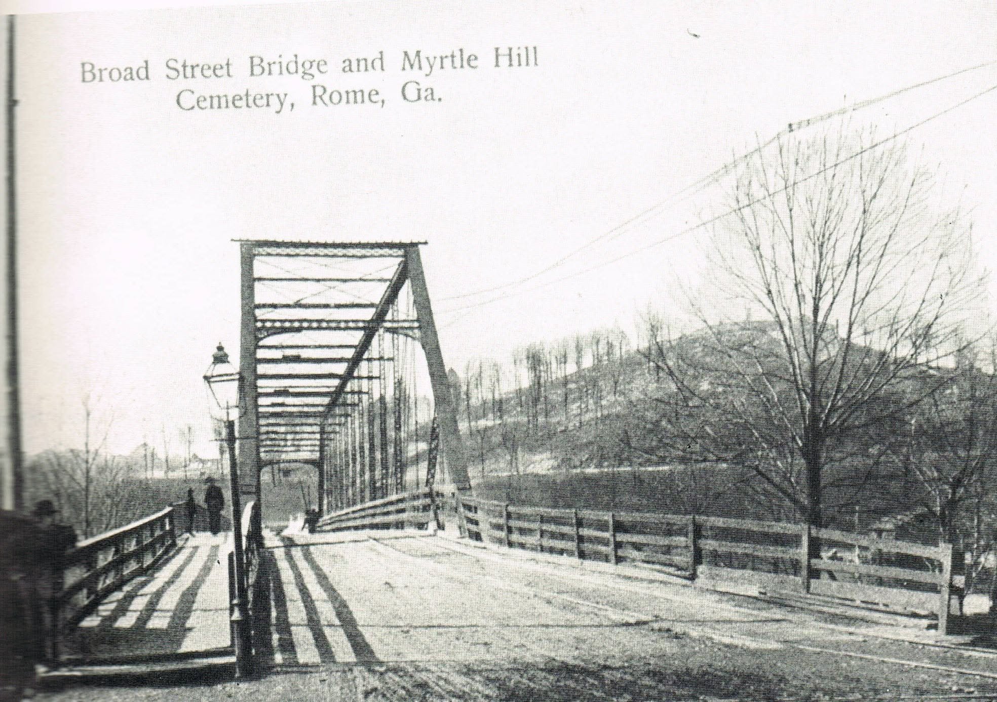
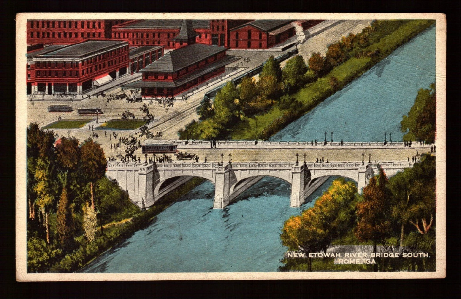
Before the concrete arches that carry Broad Street across the Etowah today, the approach to South Rome looked very different. A covered wooden bridge stretched from the foot of Broad Street toward Myrtle Hill, its enclosed truss forming a long, dark passage across the river.
The Georgia Archives identifies it as the South Rome Bridge—or Old Broad Street Bridge—and dates the surviving photograph to before 1886. Myrtle Hill rises unmistakably behind it.
Then came the flood.
In April 1886, the Etowah and Oostanaula overwhelmed Rome. The South Rome bridge was among the crossings destroyed. In the immediate aftermath, Floyd County ordered ferry service at Broad Street, then temporary pontoon crossings while the city struggled to reconnect itself.
For a city built between rivers, losing a bridge wasn't simply losing a piece of infrastructure. It could sever an entire part of town.
The crossing was rebuilt with steel and iron, and rebuilt again with the concrete arch bridge completed in 1917—the bridge that still carries South Broad across the Etowah today.
That means the location tells almost the entire evolution of American bridge construction in miniature: wood, temporary military engineering, iron and steel, then reinforced concrete.
The Other Second Avenue Bridge
And here is where Rome's geography makes the story wonderfully confusing. Second Avenue crosses both rivers.
South of downtown, it crosses the Etowah. North of Broad Street, it crosses the Oostanaula.
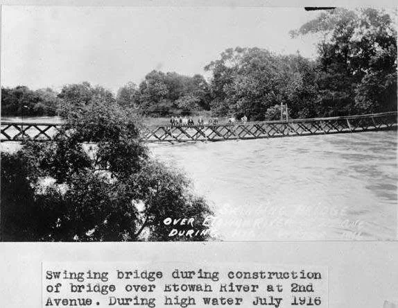
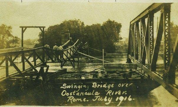
One photograph captures a wonderful transitional moment in July 1916: a temporary swinging bridge across the Etowah at Second Avenue while a permanent replacement was under construction. The Georgia Archives identifies the image specifically as the temporary crossing during high water.
Imagine using it.
Today we expect a bridge to make a river disappear beneath us. That narrow suspended crossing did the opposite. The water, movement and vulnerability of crossing it would have been impossible to ignore.
The Railroad Bridges
Road bridges were only part of the picture.
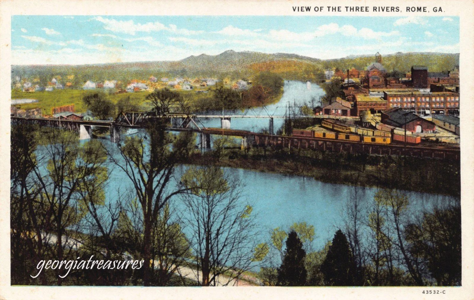
Railroads converged on Rome, and their tracks also had to negotiate the rivers. Old photographs consequently show a landscape of overlapping transportation systems: streets, streetcars, railroads, riverboats and bridges occupying the same relatively small piece of geography.
Some railroad crossings disappeared completely. Others left fragments.
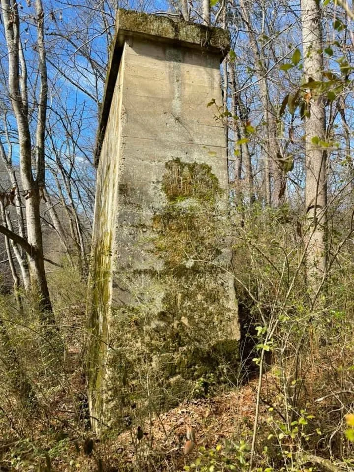
Near today's trail crossing of the Etowah, for example, concrete or masonry supports from an earlier Southern Railway bridge still stand beside the river. Historic bridge records identify the former crossing as a through-truss railroad bridge; the superstructure is gone, but its supports remain.
STAND HERE.
Stand on the trail near the Etowah and look at the abandoned bridge pier rising from the woods.
It looks strangely purposeless now—a massive piece of stone and concrete supporting nothing.
But that's exactly why it matters.
Infrastructure usually disappears so completely that we forget it was ever there. A surviving pier works almost like an architectural fossil. Once you understand what it supported, you can mentally extend the bridge back across the river.
The landscape begins filling itself in.
The Bridge We Didn't Lose
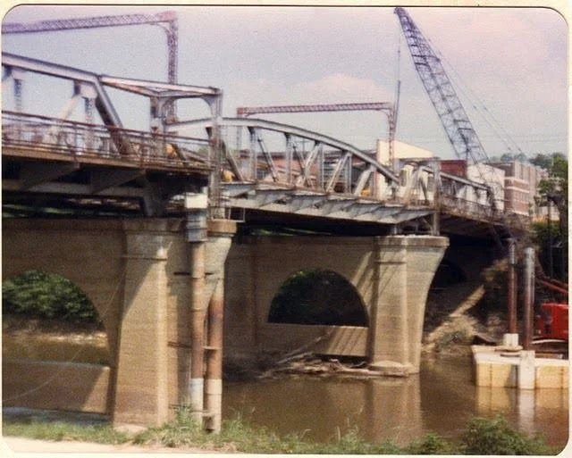
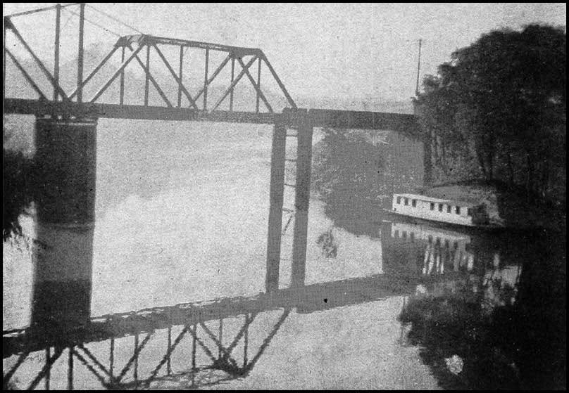
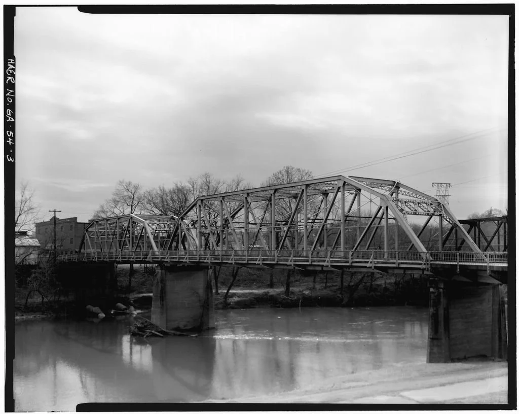
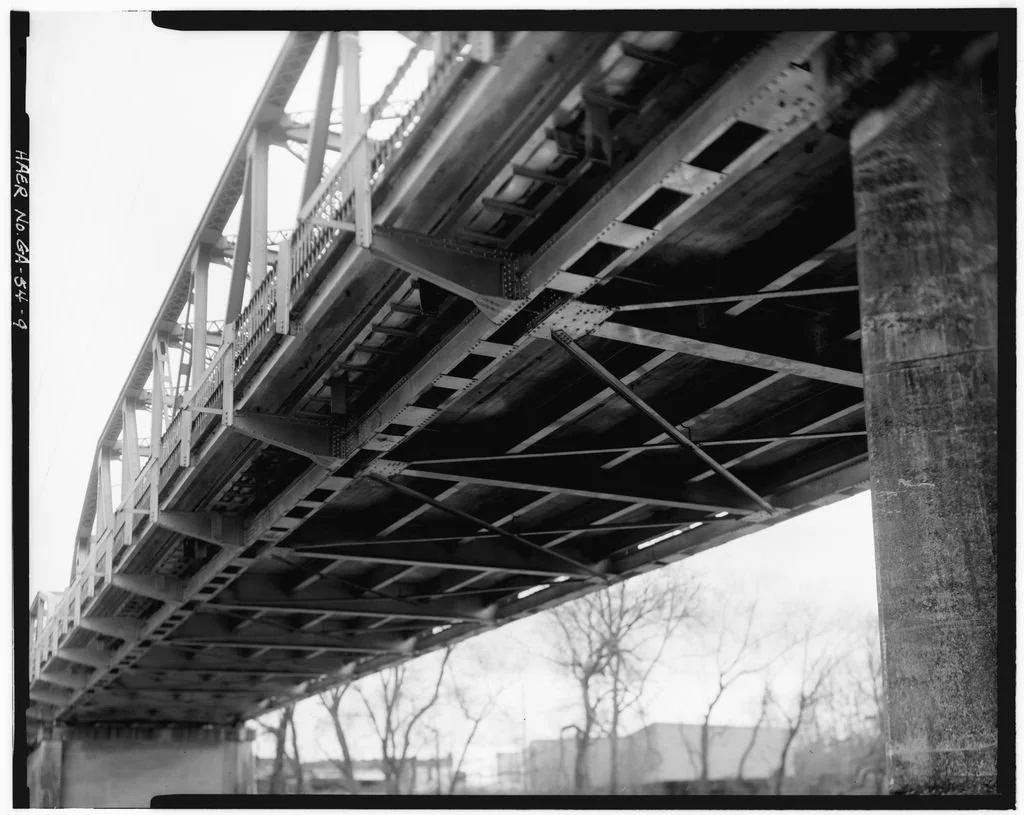
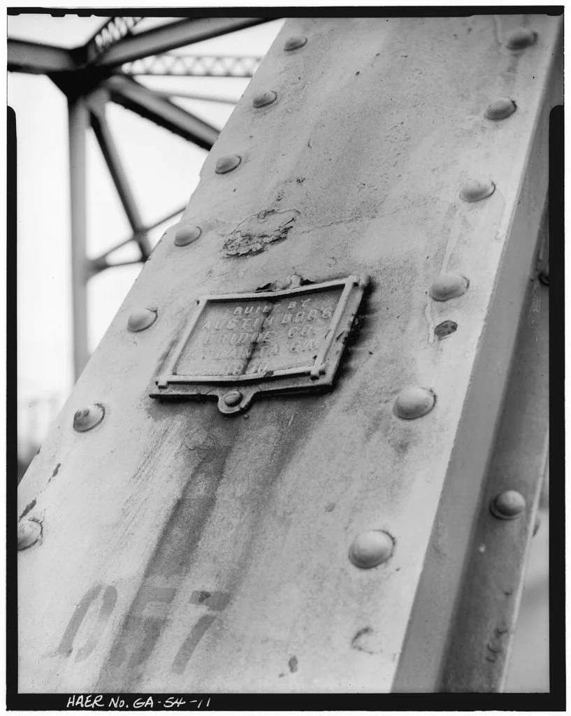
There is the exception of course, the Robert Redden Footbridge survives. Built in 1905 by the American Bridge Company for the Central of Georgia Railway, it was originally a movable railroad bridge across the Oostanaula near the confluence. Its steel truss could rotate around a center pier, opening the river channel for steamboats.
Look closely at the bridge today and the engineering still tells the story, even though the machinery that once allowed it to rotate has largely disappeared. When the railroad abandoned the crossing, Rome could easily have removed it. Instead, the bridge found another job.
In 1976 it was converted for pedestrian use as what local tourism officials describe as Georgia's first rail-to-trail project. Today it connects Heritage Park and Bridgepoint Plaza and has become one of the most recognizable pieces of Rome's riverfront. That makes it an unusually good preservation lesson. We did not preserve it by freezing it in 1905. We preserved it by making it useful in 1976. And fifty years later, people are still crossing the Oostanaula on it.
What We Lost When the Bridges Disappeared
It would be easy to romanticize all of this. Old steel bridges were narrow. They required maintenance. They became inadequate for heavier vehicles and increasing traffic. Movable bridges were mechanically complicated. Infrastructure has to work, and cities cannot preserve every obsolete piece of engineering simply because it photographs beautifully.
But function isn't the whole story. Compare the old photographs with the crossings that replaced these bridges and something becomes obvious. Earlier bridges often made their engineering visible. Their structure rose above the roadway. You could see how loads moved through trusses, where spans rested on piers, and—in the case of movable bridges—how the architecture responded to the river below.
They taught you something simply by crossing them. Modern bridges often do the opposite. Their engineering is beneath us, intentionally unobtrusive. They are generally wider, smoother and far better suited to the traffic they carry. But visually, the crossing has almost disappeared.
That may be the most interesting architectural story here. Rome didn't lose its bridges. Rome lost a particular way of experiencing them.
Jeb's Take
I've always thought Rome's rivers are among the city's greatest assets. They create views, edges, approaches and natural boundaries that have shaped nearly everything built around them.
The old bridges responded to that geography very differently than today's bridges do.
They stood up.
Their trusses and towers became part of the city. They framed views down streets. They made the rivers visible before you ever reached the water. And because some of them moved, they acknowledged that the river wasn't merely scenery beneath a road. It was another transportation system altogether.
I don't think that means we should have saved every one of them. Cities change, engineering improves and infrastructure eventually reaches the end of its useful life.
But I do think there is a lesson in the one historic bridge we kept.
The Robert Redden bridge survived because we found another reason to cross it.
And maybe that's one of preservation's simplest truths: sometimes the best way to save an old structure is to give it a new job.
________________________________
1. THE BRIDGES WE LOST
Rome’s bridges used to be a lot more interesting.
Before the relatively unobtrusive concrete crossings we know today, Rome’s rivers were spanned by covered bridges, towering steel trusses, movable lift bridges, railroad bridges—and even temporary crossings built after floods.
Some were landmarks in their own right. The old Fifth Avenue Bridge had four towers rising above the Oostanaula. The Second Avenue bridge surrounded drivers in a cage of steel. At South Broad, an enclosed wooden bridge once carried people across the Etowah beneath Myrtle Hill.
Most are gone.
But old photographs let us reconstruct a version of downtown Rome where crossing a river wasn’t something you barely noticed. The bridges were part of the skyline.
The newest Rome Home Journal: The Rome You Can’t See Anymore looks at the lost bridges of downtown Rome—where they stood, how they worked, what replaced them, and a few remnants you can still find today.
Read The Bridges We Lost at jebarp.com.
Which old Rome bridge do you remember—or wish had survived? Please share your photographs and memories in the comments.
And while researching these bridges, I stumbled onto something I absolutely did not expect:
One of them helped send Rome, Georgia, all the way to the United States Supreme Court.
More on that one soon.
2. THE SUPREME COURT BRIDGE FIGHT
Did you know a fight over Rome’s bridges once went all the way to the United States Supreme Court?
I certainly didn’t.
While researching my recent story about downtown Rome’s lost bridges, I kept encountering references to streetcar tracks. That led me to a 1917 Supreme Court case with an irresistible name:
Rome Railway & Light Company v. Floyd County, Georgia.
The argument had been brewing for decades. It involved mule-drawn streetcars, the catastrophic flood of 1886, electrification, aging bridges, Floyd County—and eventually a massive plan to rebuild Rome’s crossings for a new century.
The question at the center of it sounds surprisingly modern:
When public infrastructure needs to be replaced, who should pay for it?
Floyd County thought the private streetcar company that depended on its bridges should help foot the bill.
The streetcar company disagreed strongly enough to take Floyd County to the highest court in America.
And while all of this was being argued, some of the extraordinary bridges in the photographs I recently shared were actually being built.
The newest Rome Home Journal tells the whole story—and what the Supreme Court ultimately decided.
Read The Bridge Fight That Went to the Supreme Court at jebarp.com.
But researching the case left me with another question:
What was it actually like when streetcars ran through Rome?
That story is next.
3. WHEN ROME RODE THE STREETCAR
For 44 years, Rome had streetcars. Then they almost completely disappeared.
Look closely at old photographs of Broad Street and you'll see the evidence.
Rails beneath the traffic. Wires overhead. Cars running down the middle of streets and across the bridges. And beginning in 1885, Romans could pay a nickel, climb aboard—and let a pair of mules do the driving.
Yes. Mules.
Eventually electricity replaced them, and Rome developed a surprisingly substantial streetcar network connecting downtown with neighborhoods, mills and even Lindale.
The streetcars didn't simply move people through Rome. They helped shape where Rome grew.
There was a large car barn and repair complex near downtown. Streetcar infrastructure crossed the rivers. The system even helped support Mobley Park as a destination—because giving people somewhere to go also gave them a reason to buy a streetcar ticket.
Then came the automobile.
On September 16, 1929, Rome’s streetcars stopped running. Buses took their place, the wires came down, the tracks disappeared, and an entire layer of the city gradually became almost invisible.
The newest Rome Home Journal: The Rome You Can’t See Anymore looks at the rise and fall of Rome’s streetcar system—and what it teaches us about the way transportation shapes architecture and cities.
Read When Rome Rode the Streetcar at jebarp.com.
Do you have old photographs showing Rome’s streetcars, tracks or overhead wires? Please share them in the comments. I’d especially love to see photographs from outside downtown.
Because once you know what to look for, old photographs of Rome start telling a completely different story.